


EVANSVILLE OUTSIDE Voting District, Natrona County, Wyoming
About
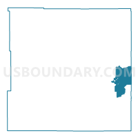
Outline

Summary
| Unique Area Identifier | 698755 |
| Name | EVANSVILLE OUTSIDE Voting District |
| County | Natrona County |
| State | Wyoming |
| Area (square miles) | 130.59 |
| Land Area (square miles) | 129.78 |
| Water Area (square miles) | 0.80 |
| % of Land Area | 99.38 |
| % of Water Area | 0.62 |
| Latitude of the Internal Point | 42.87291640 |
| Longtitude of the Internal Point | -106.17086310 |
Maps


Graphs
Select a template below for downloading or customizing gragh for EVANSVILLE OUTSIDE Voting District, Natrona County, Wyoming


Neighbors
Neighoring Voting District (by Name) Neighboring Voting District on the Map
- BOXELDER Voting District, Converse County, WY
- CENTENNIAL JUNIOR HIGH Voting District, Natrona County, WY
- EVANSVILLE INSIDE Voting District, Natrona County, WY
- HAT SIX RANCH Voting District, Natrona County, WY
- KELLY WALSH HS Voting District, Natrona County, WY
- RED CREEK SCHOOL Voting District, Natrona County, WY
- ROOSEVELT SCHOOL Voting District, Natrona County, WY
- RURAL GLENROCK Voting District, Converse County, WY
- ST STEPHENS CHURCH Voting District, Natrona County, WY
- UNIVERSITY PARK SCHOOL Voting District, Natrona County, WY
- VERDA JAMES SCHOOL Voting District, Natrona County, WY
- WARDWELL WATER & SEWER Voting District, Natrona County, WY
- WILLARD SCHOOL Voting District, Natrona County, WY
Top 10 Neighboring County Subdivision (by Population) Neighboring County Subdivision on the Map
- Casper CCD, Natrona County, WY (52,399)
- Casper South CCD, Natrona County, WY (10,489)
- Casper North CCD, Natrona County, WY (5,620)
- Glenrock CCD, Converse County, WY (4,296)
Top 10 Neighboring Place (by Population) Neighboring Place on the Map
- Casper city, WY (55,316)
- Evansville town, WY (2,544)
- Meadow Acres CDP, WY (198)
- Brookhurst CDP, WY (185)
Top 10 Neighboring Unified School District (by Population) Neighboring Unified School District on the Map
Top 10 Neighboring State Legislative District Lower Chamber (by Population) Neighboring State Legislative District Lower Chamber on the Map
- State House District 35, WY (11,445)
- State House District 58, WY (10,860)
- State House District 38, WY (9,702)
- State House District 6, WY (9,518)
- State House District 56, WY (9,056)
- State House District 36, WY (8,875)
Top 10 Neighboring State Legislative District Upper Chamber (by Population) Neighboring State Legislative District Upper Chamber on the Map
- State Senate District 30, WY (20,562)
- State Senate District 27, WY (20,320)
- State Senate District 2, WY (18,410)
- State Senate District 28, WY (17,863)
Top 10 Neighboring 111th Congressional District (by Population) Neighboring 111th Congressional District on the Map
Top 10 Neighboring Census Tract (by Population) Neighboring Census Tract on the Map
- Census Tract 14.01, Natrona County, WY (5,620)
- Census Tract 16.02, Natrona County, WY (5,596)
- Census Tract 2, Natrona County, WY (4,385)
- Census Tract 4, Natrona County, WY (4,185)
- Census Tract 18, Natrona County, WY (4,136)
- Census Tract 9566, Converse County, WY (3,194)
- Census Tract 5.02, Natrona County, WY (2,776)